 Mae-hotaka-dake or Mt.Mae-Hotaka is a cool mountain that stands out in the Hotaka mountain range. The eastern wall was the setting for Yasushi Inoue’s novel “Die Eiswand”.
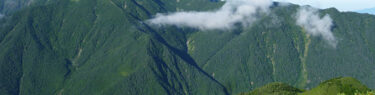
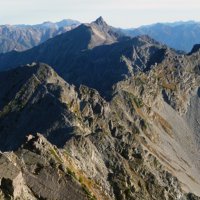
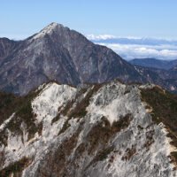
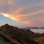
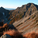
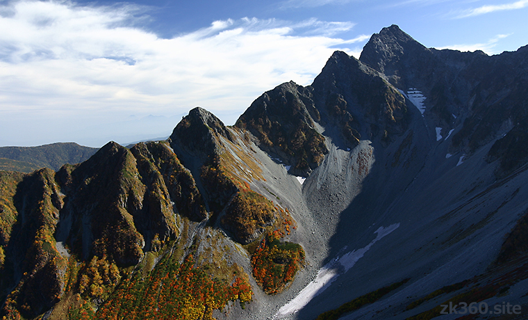
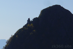
 Photo 1: Mt.Mae-Hotaka seen from the mountain trail leading up to Mt.Kita-Hotaka. The rocky peaks like the dorsal fin of a dinosaur that continues from the top of the mountain to the left are the north ridges. (2002/10/3)
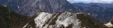
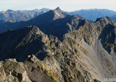
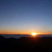
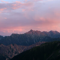
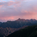
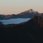
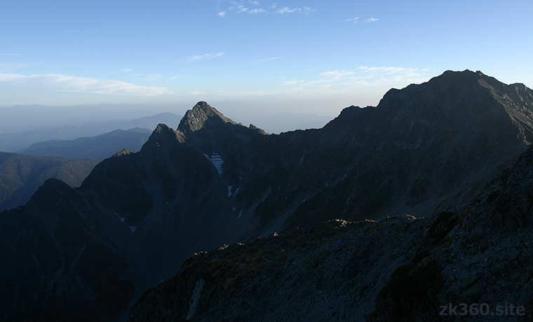
 Photo 2: Mt.Oku-Hotaka (right) and Mt.Mae-Hotaka seen from near the summit of Mt. Kita-Hotaka in the evening of the same day. The expression of the mountain changes depending on the light. (2002/10/3)
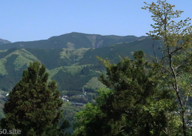
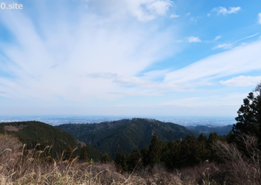
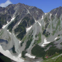
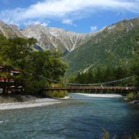
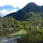
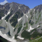
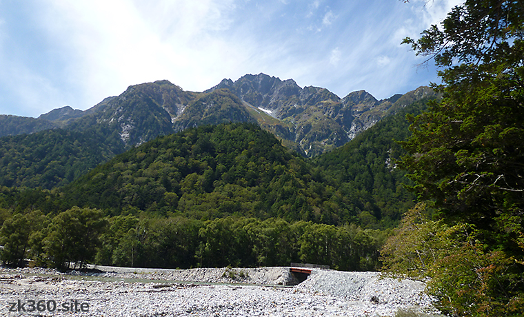
 Photo 3: Mt.Mae-Hotaka looking up from the Azusa River. This scenery is one of the pleasures of walking along a long forest road from Kami-kouchi to Yokoo. (2017/9/25)
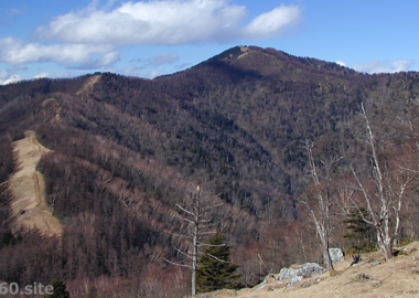
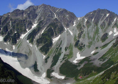
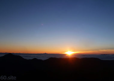
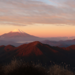
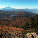
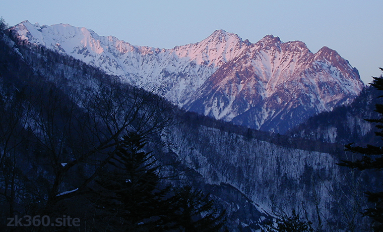
 Photo 4: The Hotaka mountain range in winter seen from near Nakanoyu spa. The white mountain on the left is Mt.Oku-hotaka, the center is Mt.Mae-hotaka via the Tsuri-one ridge, and the right is Mt.Myojin. (2001/2/21)
The title image changes every 5 seconds.
At the summit of Mt. Mae-Hotaka, we can see the popular peaks of Northern Alps.
In the book “One Hundred Mountains of Japan”, the mountains in this area are collectively referred to as Mt.Hotaka, but the main peak is Mt.Oku-Hotaka, the highest peak. Mt.Mae-hotaka is connected to Mt.Oku-hotaka by a Tsuri-one ridge.
The altitude of Mt.Mae-Hotaka is 3090.5m, which is the 4th in the Hotaka mountain range, but I think it is the most stylish mountain. The top of the mountain looks sharp, but when you climb it, it is surprisingly wide.
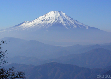
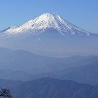
This mountaintop is a spectacular observatory. You can see not only the main mountains in the southern part of Northern Alps, but also Tateyama and Ushiro-Tateyama mountain range in the north. Looking south, you can see Mt.Norikura, Mt.Ontake, the Central Alps, the Southern Alps, and Mt.Fuji. To the east, you can see Yatsu-ga-take and Mt.Asama.
*The following two panoramic photos can be viewed on a wider screen by clicking or tapping the letters THETA at the bottom left of the screen.
この写真は、Webサイト『絶景360』の一部です。日本語版は、こちら(https://zk360.site)からご覧いただけます。 This photo is part of the website “zk360.site”. English version URL is https://e.zk360.site/ – Spherical Image – RICOH THETA
Spherical panoramic photo at the summit of Mt. Mae-Hotaka. (2016/9/30)
この写真は、Webサイト『絶景360』の一部です。日本語版は、こちら(https://zk360.site)からご覧いただけます。 This photo is part of the website “zk360.site”. English version URL is https://e.zk360.site/ – Spherical Image – RICOH THETA
Spherical panoramic photo at the summit of Mt. Mae-Hotaka. (with mountain name)
There is a raccoon dog in Mt.Mae-Hotaka !?
 Looking up at Mt.Mae-Hotaka from Karasawa, the north ridge extends to the left from the summit. Each peak has a name, the peak1 is the top and peak2 and 3 in the same rock mass. The second triangle has peak4, and the slightly gentle third has peak5.
Below that, sharply pointed rock is peak6. If you look closely at the left slope of it, something is standing. Doesn’t it look like a raccoon dog in an animation? If you go to Karasawa, please look for it.
Overlooking Kami-kouchi from Thunderbird Square.
If you climb from Kami-kouchi to Mt.Mae-Hotaka via Dakesawa, you will find a place with a great view called “Raicho Hiroba” just before the branch point of Kimiko-daira. Raicho is Thunderbird, and Hiroba meens square or plaza.
Spherical panoramic photo at Thunderbird Square (2016/9/30). Click or tap the word THETA at the bottom left of the screen to see a wider screen.
この写真は、Webサイト『絶景360』の一部です。日本語版は、こちら(https://zk360.site)からご覧いただけます。 This photo is part of the website “zk360.site”. English version URL is https://e.zk360.site/ – Spherical Image – RICOH THETA
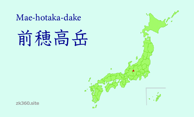
Mountain area
Southern part of Japan North Alps.
How to access to Mt. Mae-hotaka
(1) Enter Dakesawa from Kami-kouchi and stay overnight at Dakesawa Hut. The next day, climb the Jutaro Shindo route and head toward the summit from the branch point of Kimiko-daira.
(2) From Karasawa or Shin-hotaka Onsen, go up to Shiradashi-no-col and stay at Hotakadake Sanso Hut. The next day, over Mt.Oku-hotaka, pass the Tsuri-one ridge, go to Kimiko-daira, and head to the summit. This route is a little long and difficult.
To A-Z index
To area index