 This is Mt. Ko-kumotori or Ko-kumotori-yama in Okutama, western Tokyo. It is a different mountain from Kogumotori on Nakahechi of the Kumano Kodo in western Japan.
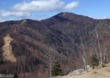
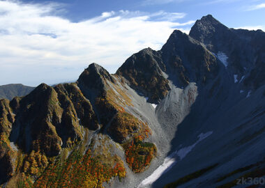
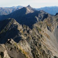
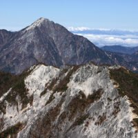
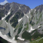
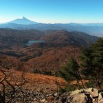
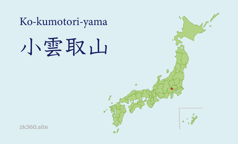
 Photo 1: Mt. Kumotori seen from Mt. Nanatsuishi in Okutama. Just below the summit, another triangular point is Mt. Ko-kumotori. (2017/5/23)
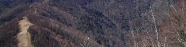
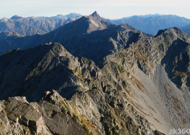
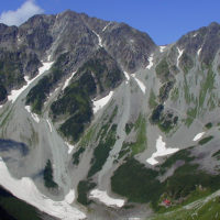
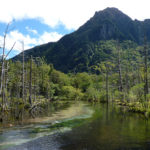
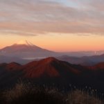
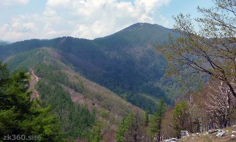
 Photo 2: Actually, there is no place that seems to be a peak. However, this small hill-like place is the summit of Mt. Ko-kumotori. (2017/5/23)
The title image changes every 5 seconds.
There are no noticeable peaks, but I recommend stopping at the summit of this mountain.
When asked about “Kokumotori” in Japan, Mt. Kogumotori in Wakayama Prefecture is more known than Mt. Ko-kumotori in Okutama, Tokyo. The pronunciation is slightly different, but it is the same as writing in Japanese characters. And this article introduces Mt. Ko-kumotori in Okutama.
“Ko” at the beginning of the mountain name means “small” in Japanese. So, Mt. Ko-kumotori means “small Mt. Kumotori”.
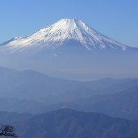
Mt. Kumotori is located on the western edge of Tokyo, on the border between Yamanashi and Saitama prefectures. It is the highest peak in Tokyo and has been selected as the “One Hundred Mountains of Japan”.
In Okutama, there is a mountain called Mt. Nanatsuishi. From there, you can see another triangular mountain shape just below the peak of Mt. Kumotori. Maybe this is Mt. Ko-kumotori.
However, when we go to that place, there is no mountain peak. There is no sign of the mountaintop. There is only a trail branch suitable for a break.
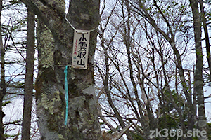
Actually, the place like a small hill in Title Photo 2 is Mt. Ko-kumotori, and there is a narrow trail on the left. In less than a minute, you will reach the summit of Mt. Ko-kumotori, which is surrounded by trees.
The mark is only a small handmade sign, the altitude is 1936m. When I went in May 2017, there was a small sign hanging on the tree.
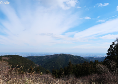
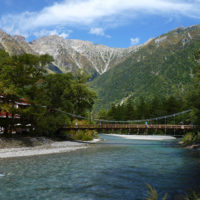
Now, enjoy the spherical panoramic photos. First, in front of a hill with the mountain. This is also a pleasant place with a good view.
*Both of them can be viewed on a wider screen by clicking the word THETA at the bottom left of the screen.
この写真は、Webサイト『絶景360』の一部です。『絶景360』は、こちら(https://zk360.site)からご覧いただけます。 – Spherical Image – RICOH THETA
Spherical panoramic photo in front of Mt. Ko-kumotori (2017/5/23)
Next is a spherical panoramic photo taken at the summit of Mt. Ko-kumotori.
この写真は、Webサイト『絶景360』の一部です。『絶景360』は、こちら(https://zk360.site)からご覧いただけます。 – Spherical Image – RICOH THETA
Spherical panoramic photo at the summit of Mt. Ko-kumotori (2017/5/23)
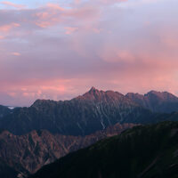
In the second spherical panoramic photo, I would like you to see the sky. You can see directly above by scrolling the screen downwards.
Under this sky, we humans have lived for thousands or tens of thousands of years, surrounded by trees. The peak of the rocky ridge overlooking the distance is attractive, but I think that the mountaintop where you can feel the peace like this is also good.
Mountain area
Southern part of Kanto region (Okutama)
Access to Mt. Ko-kumotori
(1) From JR Okutama Station, take a bus bound for Syonewdou (limestone cave) to Naka-Nippara (to Higashi-Nippara on Saturdays and Sundays), walk along the Nippara Forest Road, and then climb to Mt. Ko-kumotori. This is the shortest route. However, this course may be closed due to the collapse of the mountain trail, so check in advance.
(2) From JR Okutama Station, take a bus bound for Kamosawa-Nishi or Taba and get off at Kamosawa. From there you can climb Mt. Nanatsuishi and then to Mt. Ko-kumotori. An ordinary climber can reach the summit in a day. When going by car, there is a parking lot for climbers up the forest road from the side of Kamo Shrine.
(3) It is an attractive long route from JR Okutama Station to Mt. Kumotori via Mt. Mutsuishi, Mt. Takanosu, and Mt. Nanatsuishi. If you go this course, you will pass Mt. Ko-kumotori just before Mt. Kumotori. However, most climbers stay overnight at Nanatsuishi hut on the way. The Okutama hut closed in March 2019 and has now been removed and nothing is left. Staying in a tent is also prohibited (as of September 2021).
(4) It is also good to climb Mt. Kumotori first and stop at Mt. Ko-kumotori on the way down. 20 minutes course time from Mt. Kumotori to Mt. Ko-kumotori. After that, it takes about 3 hours from Mt. Nanatsuishi to Kamosawa bus stop. It takes about 6 hours to walk from Mt. Nanatsuishi to JR Okutama Station. None of them include breaks.
Click here to an article of Mt. Kumotori.
To A-Z Index
To Area Index