 Mt. Fuji is a symbol of Japan. Many people want to step on its summit. In this article, I explain the beauty of Mt. Fuji, the view of the summit and sunrise, and how to climb.
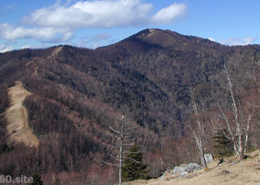
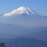
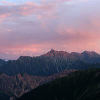
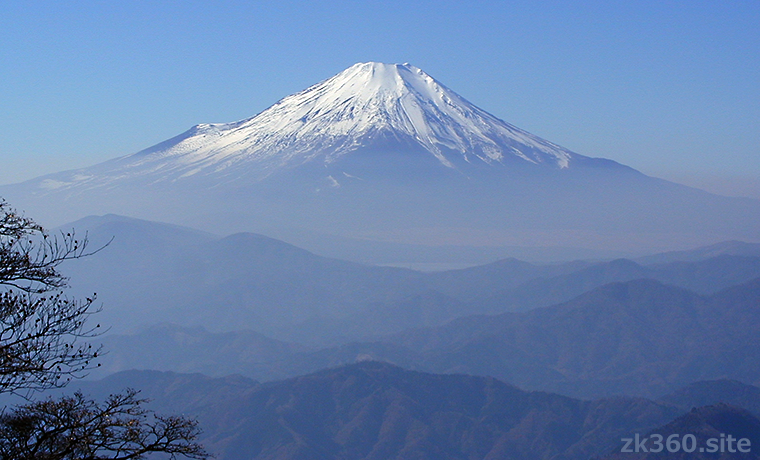
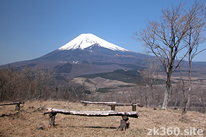
 Photo 1: The typical Mt. Fuji that Japanese people envision is like this. This photo was taken at Hinokiboramaru in the Tanzawa Mountains. (2001/11/24)
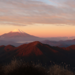
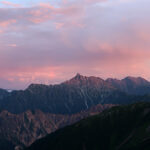
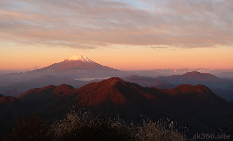
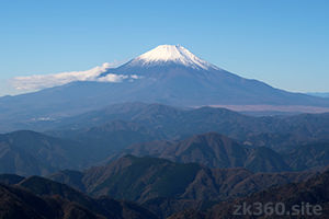
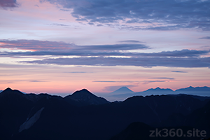
 Photo 2: Mt. Fuji in the morning as seen from Hiru-ga-take in Tanzawa. In the evening, you can see the silhouette of Mt. Fuji in the sunset sky here. (2011/11/16)
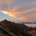
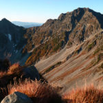
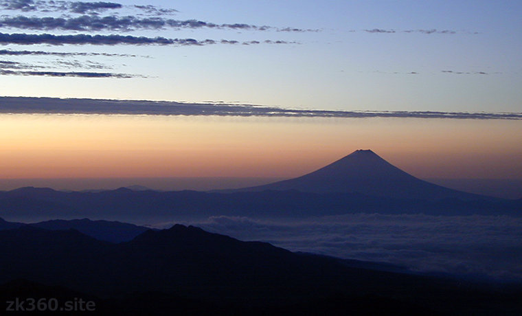
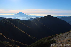
 Photo 3: Mt. Fuji at dawn as seen from Aka-dake, the main peak of Yatsu-ga-take. A view reminiscent of Ukiyo-e prints by Katsushika Hokusai. (2000/10/14)
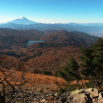
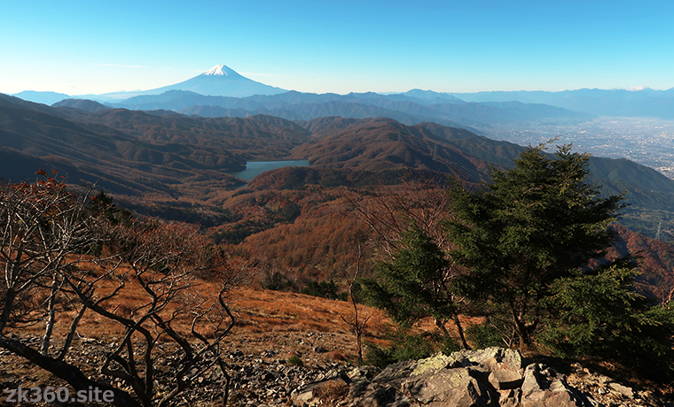
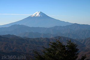
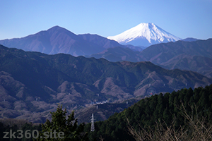
 Photo 4: Mt. Fuji in autumn as seen from Mt. Daibosatsu. One of the reasons for its popularity is that it can be identified as Mt. Fuji from a distance. (2018/10/30)
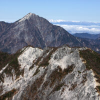
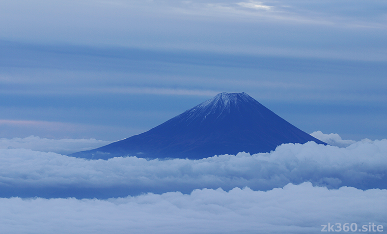
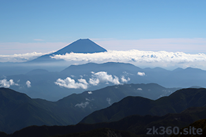
 Photo 5: Mt. Fuji above the clouds as seen from Kan-non-dake in the Southern Alps. This is a view that can only be seen from a high mountain. (2003/10/25)
The title image changes every 5 seconds.
Not only the height, Mt. Fuji has been deeply connected with Japanese culture.
There is no Japanese who does not know Mt. Fuji or Fuji-san.
Kyuya Fukada, the author of “One Hundred Mountains of Japan,” wrote at the beginning of the “Mt. Fuji” section, “What should I say about this number one mountain in Japan?” And in the text, it is called “national mountain” and “popular mountain”.
It may be a little disappointing for those who want to climb the highest mountain in Japan once in a lifetime. But in reality, those who like mountain climbing will not want to climb Mt. Fuji many times. Because it looks beautiful, but it’s not difficult to climb.
However, there is no mountain that is more popular than Mt. Fuji. In Japan, it has long been the theme of literature and art. And there is a history of religious mountaineering. That cultural aspect is extremely important.
In 2013, Mt. Fuji was registered as a UNESCO World Heritage Site as “Mt. Fuji-the object of worship and the source of art”. It is not a natural heritage, but is registered as a cultural heritage along with the surrounding shrines and natural sculptures. The relationship between Mt. Fuji and the Japanese was highly evaluated. This mountain is so deeply rooted in Japanese culture that it has had a great influence on the Japanese mind.
It can be identified as Mt. Fuji from any direction.
So why is Mt. Fuji so popular? First, it has the highest altitude in Japan. And the conical shape and the appearance of wearing snow are very beautiful.
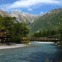
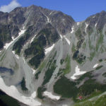
It is also important that Mt. Fuji is a huge independent mountain. Therefore, it can be viewed from all directions. First, let’s look at Mt. Fuji from the north, south, east and west.
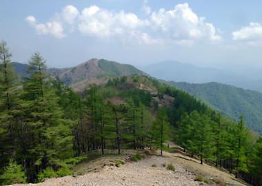
View of the north side of Mt. Fuji from Mt. Daibosatsu.
View of the south side of Mt. Fuji from Mt. Ashitaka.
View of the eastern side of Mt. Fuji from Tou-no-take in Tanzawa.
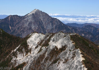
View of the west side of Mt. Fuji from Koumori-dake in the Southern Alps.
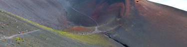
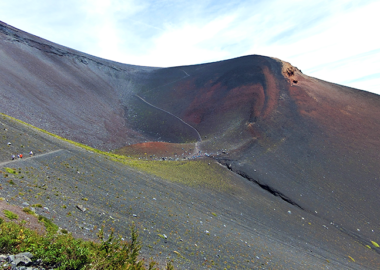
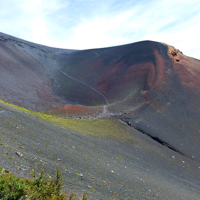
Mt. Fuji is not a perfect cone and has a steep southwestern slope. Therefore, it looks slightly tilted depending on the viewing direction. There is a large hole in the Houei crater on the southeastern slope, the edge of which is called Mt. Houei. Mt. Houei is introduced in this article.
Next is the view of Mt. Fuji from a distance. Anyone can recognize Mt. Fuji because of its unique trapezoidal silhouette.
Mt. Fuji seen from Mt. Takao in the suburbs of Tokyo. On a clear day, you can see Mt. Fuji from the mid of Tokyo.
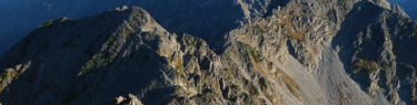
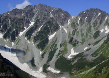
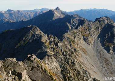
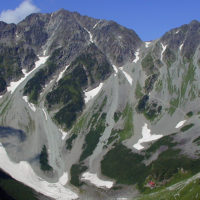
Mt. Fuji seen from Mt. Shiomi. The triangular mountain to the right is Koumori-dake. The Southern Alps is close to Mt. Fuji, so there are many view spots.
A distant view of Mt. Fuji from the Suisyo-goya hut in the Northern Alps. The straight line distance is about 154km. From the Northern Alps, it can be seen between Yatsu-ga-take and the Southern Alps.
So, if you stand in a place with a good view from the Kanto region to the Chubu region, you can usually see Mt. Fuji. In Japanese TV programs, it is customary for guests to say “Wow, Mt. Fuji!” When they see Mt. Fuji.
Climb Mt. Fuji and stand at the highest point in Japan.
Many people want to climb Mt. Fuji once. We can climb Mt. Fuji for about 10 weeks from July 1st to September 10th. During this period, more than 200,000 people enter the mountain every year.
During the non-climbing season (from around September 11th to June 30th), the trails are closed and we cannot climb above the 5th station. And mountain lodges are also closed.
There are four climbing routes for Mt. Fuji. See the access section at the bottom of this article for more information.
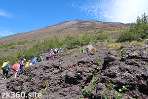
The entrance to the mountain trail on the Fujinomiya route.
Climb the mountain trail on the Fujiyoshida route.
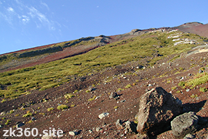
When you climb up, the top of Mt. Fuji is a huge hole with a diameter of about 700m. This hole is the crater and is called “Ohachi”. Ohachi means bowl. And the crater edge is uneven, with some named peaks. The highest of these is Kengamine at an altitude of 3776m.
You will feel a sense of accomplishment when you climb the long mountain trail and reach the edge of the crater. However, it is not the highest point in Japan. When climbing from the Shizuoka side, the peak on the left is Kengamine, the highest point. If you climb from the Yamanashi side, you will reach Kengamine by going around the crater about halfway.
It takes about an hour and a half to go around the crater, which is called “Ohachi-meguri”. It is difficult to climb from Sengen Taisha Okumiya Shrine to Kengamine, but when you climb up this slope, you will find the monument of the highest point.
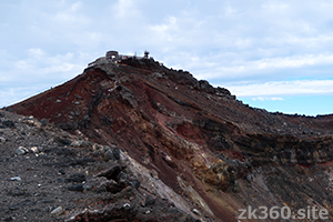
The highest point in Japan, the peak of Kengamine. The steep slope on the left is the last difficult place.
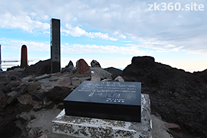
A stone pillar showing the highest peak in Japan and a guide plate with a triangular point.
Now, take a look at the spherical panoramic photos taken at the highest point in Japan.
この写真は、Webサイト『絶景360』の一部です。『絶景360』は、こちら(https://zk360.site)からご覧いただけます。 This photo is a part of the website "zk360.site". The URL of English version is https://e.zk360.site/ – Spherical Image – RICOH THETA
At the summit of Kengamine. (2018/9/6)
As you can see, there is a huge crater in front. And the building behind is a meteorological station. Previously the white dome was the symbol of this building. And the observer was staying. Now the dome has been removed and an automatic meteorological observation device is installed.
Mt. Fuji is so tall and vast that you don’t enjoy seeing the surrounding mountains. However, if you go around the crater, you can see Mt. Ashitaka, Tanzawa, Lake Yamanaka, Suruga Bay, etc.
In Japanese nursery rhymes, Mt. Fuji is sung as “putting its head on the clouds.” In fact, the summit is often higher than the clouds and the sea of clouds extends below. On the other hand, when you look up at the sky, the blue is dark and it feels like space.
The concentration of air at the summit of Mt. Fuji is about two-thirds of the sea level, and many people have symptoms of altitude sickness. I always have a headache when I go around the crater of Mt. Fuji.
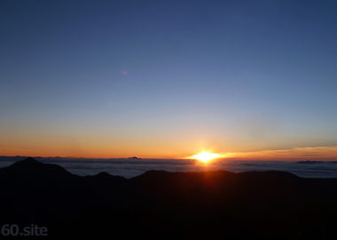
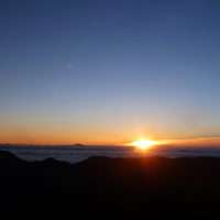
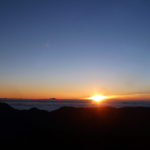
The sunrise seen at the summit of Mt. Fuji, its superb view.
Along with the commemorative photo taken at the highest point, many people are looking forward to the sunrise seen at the summit of Mt. Fuji.
Some people prefer to look from the 8th or 9th station, as looking down at the sunrise from a high place is blasphemy. Therefore, I think it is also a good plan to look at the sunrise at a place slightly below the summit.
The highest point, Kengamine, is on the west side of the mountaintop. Therefore, the area around Asahi-dake and Izuga-take on the east side is a great viewing spot of sunrise. On a calm morning with few clouds, bright and sharp rays shine from the east side.
By the way, the temperature at dawn on the summit of Mt. Fuji is about 5 degrees Celsius even in August. It’s about the same as a midwinter morning in Tokyo. It’s freezing cold while waiting for the sunrise, but when the sun rises, it suddenly feels warm. This is the moment when we feel the gratitude and greatness of the sun.
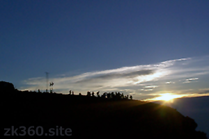
The calm morning sunrise and the people watching it.
On the day I climbed Mt. Fuji to take spherical panoramic photos for this article, there were many clouds and strong winds like typhoons. However, thanks to that, I was able to encounter a dramatic view of the sunrise, which was like the creation of heaven and earth.
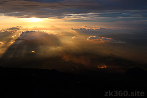
A dramatic sunrise with clouds.
Then, it is a superb panoramic photograph of the sunrise taken near Asahi-dake on the summit of Mt. Fuji.
この写真は、Webサイト『絶景360』の一部です。『絶景360』は、こちら(https://zk360.site)からご覧いただけます。 This photo is a part of the website "zk360.site". The URL of English version is https://e.zk360.site/ – Spherical Image – RICOH THETA
The sunrise seen from the top of Mt. Fuji. (2018/9/6)
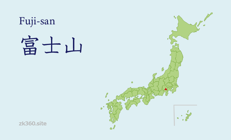
Mountain Area
Southern part of the Chubu region
Access to Mt. Fuji
There are 4 routes for climbing Mt. Fuji. In both cases, you can go to the 5th station by bus or car, and from there you will go up the mountain trail. All climbing points are called the 5th station, but the altitude of the starting point differs depending on the course.
(1) Fujinomiya-guchi: The shortest route to the summit is the Fujinomiya-guchi mountain trail on the Shizuoka side. During the mountain climbing season, there are restrictions on private cars, so park your car at the Mizugatsuka parking lot and take the shuttle bus to the 5th station. The altitude of Fujinomiya-guchi is 2380m, and the altitude difference from the summit is about 1400m. The climbing time is about five and a half hours in course time. It is also recommended to stop by Mt. Houei before climbing.
(2) Yoshida-guchi: The Fuji-yoshida route on the Yamanashi side is easily accessible from the Tokyo metropolitan area. It is popular because you can reach the 5th station by car (as of 2021) and it is easy to reach by train and bus. The altitude of Yoshida-guchi is 2305m, and the altitude difference from the summit is about 1470m. The climbing time is about 6 to 7 hours in the course time, and it goes around the crater halfway to reach the highest point, Kengamine.
(3) Gotemba-guchi: This trailhead is easily accessible by car. However, the altitude here is 1440m, and the altitude difference from the summit is more than 2300m. The climbing time is about 9 hours in the course time. Therefore, it is better to climb this route after experiencing Mt. Fuji on another route. If you choose this course when descending Mt. Fuji, you can also stop by Mt. Hoei.
(4) Subashiri-guchi: This is a route to climb from the east side. This course joins the Yoshida route around the 8th station. Be careful not to make a mistake, especially when descending the mountain. The altitude of Subashiri-guchi is 1970m, and the altitude difference from the summit is about 1800m. The climbing time is 7 to 8 and a half hours in course time. To reach the highest point, Kengamine, go around the crater halfway.
General mountaineering plan for Mt. Fuji
When climbing for the first time, I think the Fujinomiya route or the Yoshida route is good. Whichever course you go, there are two climbing plans.
(1) Start climbing as early as possible and reach the summit around noon. It is a day trip schedule to go down the mountain on the same day. You cannot see the sunrise at the top of the mountain. However, it is safe to act in bright hours and to descend easily even if you have symptoms of altitude sickness. This plan takes a long time to act, so be in good physical condition.
(2) Arrive at the 5th station in the morning and take a walk around the area to prevent altitude sickness. Then, start climbing around noon and enter the mountain lodge around the 7th to 8th stations by the evening. The next day, you wake up from 2am to 3am and head for the summit in the dark. Then, after seeing the sunrise, go to the highest point, and if you are in good physical condition, go around the crater and then descend.
With either plan, you will need to return to the same trailhead as you go by private car. On the other hand, if you go by train and bus, you can go down the mountain by a route different from the one you entered.
When climbing in Japan, it is recommended to climb slowly. The key to climbing not only Mt. Fuji is to climb slowly. Try to walk at about half the normal speed.
If a person who is not normally trained in mountaineering thinks “I’m okay” and climbs fast, legs will get stuck in 30 minutes. Then, after a few hours, he/she will sits down to the side of the mountain trail.
If you climb this way, you will have a hard time. And even if you manage to reach the top of the mountain, it is dangerous because your feet will stagger when you go down the mountain.
Equipment and measures against altitude sickness
The following description is for beginners in mountaineering.
(1) Even if you don’t have a full-fledged mountain climbing tool, the following three items are indispensable for climbing Mt. Fuji. It is mountaineering shoes and a small backpack, warm clothing or rainwear. As I wrote in the text, the morning temperature at the summit is about 5 degrees Celsius in August. When there is wind, the sensible temperature is below freezing. Also, in September, ice will form on the mountaintop. You also need headlights and emergency food. If you say “I want to climb Mt. Fuji” at a mountaineering equipment store in Japan, they will advise you on the appropriate tools.
(2) I often see people who do not usually walk in the mountains suddenly challenge Mt. Fuji and become extremely tired or ill on the way, causing trouble to the people around them. Some people say, “Two round trips in the low mountains a day” as a preliminary preparation, but it is not expected to be effective (of course, it is better than doing nothing). If possible, it is better to go to the place an altitude of 2000m or higher and walk around there for at least one day to prevent altitude sickness.
(3) When climbing a high mountain, the air is thin, so oxygen in the blood and brain is insufficient, causing various symptoms. The symptoms are collectively called altitude sickness. At first, it’s just a mild headache or nausea. However, in severe cases, it can cause pulmonary edema and cerebral edema, resulting in death. Even at the height of Mt. Fuji, many people feel the symptoms of altitude sickness. The best way to recover from symptoms is to move to a lower altitude and more airy area. Canned oxygen is sold as a countermeasure against altitude sickness, but it is actually not very effective.
(4) As a preventive measure for altitude sickness, acclimatizing the body to thin air is called altitude adaptation. The method is to gradually go to higher altitudes and move while staying there. Then, the number of red blood cells increase and less oxygen is circulated throughout the body. However, this method takes several days to be effective. It is not realistic to do this for a single climb of Mt. Fuji. Therefore, you can reduce the risk of altitude sickness by walking around the 5th station before climbing or staying overnight at the mountain lodge around the 8th station. However, while you sleep, your breathing becomes shallower and you are more likely to have symptoms of altitude sickness. When you arrive at the lodge, do not lie down for a while and take a deep breath.
To A-Z Index
To Area Index