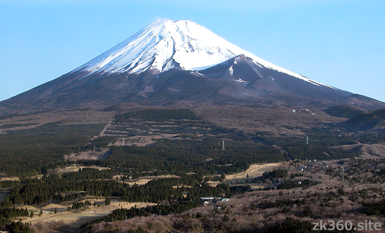

 Mt. Houei or Houei-zan is a huge crater and protrusion on the southeastern slope of Mt. Fuji. It’s not well known, but it’s a spectacular spot.
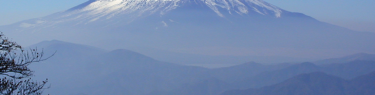
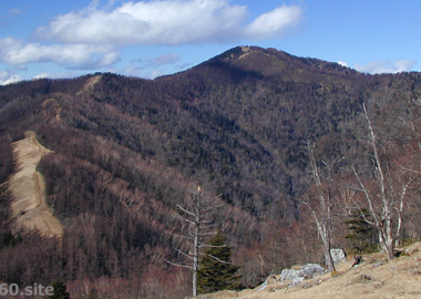
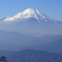
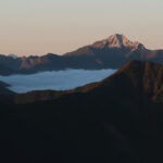
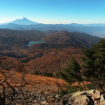
 Photo 1: Mt. Fuji seen from Mt. Ashitaka. At the lower right of the mountaintop, you can see a mountain shape that is not covered with snow. This is Mt. Hoei. The big hole to the left of it is the crater. (2017/5/23)
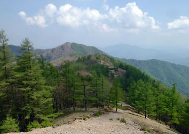
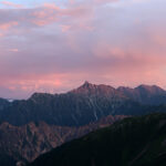
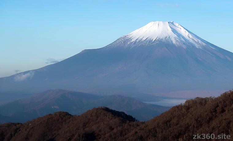
 Photo 2: Mt. Fuji seen from the Hiru-ga-take of the Tanzawa Mountains. Mt. Houei is located in the middle of the left slope and looks like a ski jumping hill. (2017/5/23)
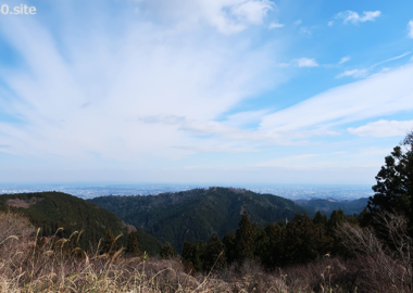
 Photo 3: If you walk up Mt. Fuji from Mizugatsuka Park, you will see this scenery around the 4th station. Mt. Houei is on the right, and Mt. Fuji is on the left across the crater. (2017/5/23)
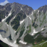
 Photo 4: When you reach the 5th station, you can see a huge crater and Mt. Houei. You can recognize how big it is compared to the person in the lower left. (2017/5/23)
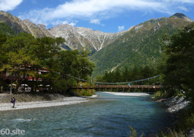
The title image changes every 5 seconds.
A little-known scenic spot on Mt. Fuji, just like Mars.
I think many people don’t know Mt. Houei. But in fact, most people should have seen it.
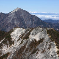
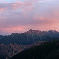
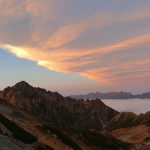
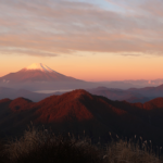
For example, the first title photo is Mt. Fuji seen from the south side. And if you look closely, you can see that there is a big hole in the middle. This is the crater of Mt. Houei. The second title photo shows Mt. Fuji from the east side. You can see that there is a step in the middle of the left slope. This end is the summit of Mt. Houei.
If you’ve seen Mt. Fuji, including photos and videos, you’ll usually see Mt. Houei at the same time. But you don’t notice it because you don’t know its existence.
Mt. Houei is the crater when Mt. Fuji erupted in 1707. This period is called the “Houei era” in Japan. Mt. Fuji has grown by repeating eruptions. And this Houei eruption is the largest and latest.
The Houei eruption lasted for two weeks, and volcanic ash fell on the city of Edo. Edo was Tokyo at that time. In addition, crops were severely damaged throughout the Kanto region. A picture of the eruption drawn at that time remains. If a similar eruption occurs now, Tokyo will be in great turmoil and Japan will suffer enormous economic damage. But the Houei eruption is a reality that happened only about 300 years ago.
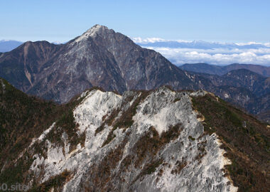
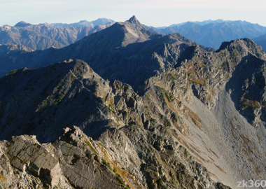
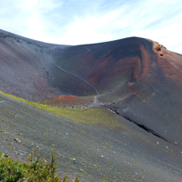
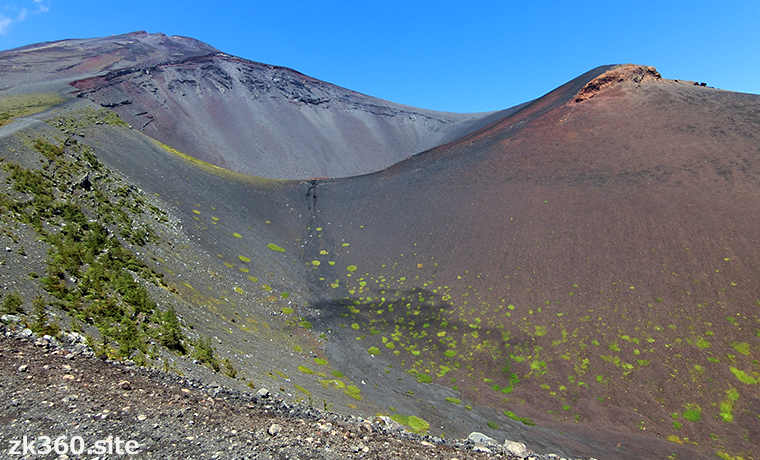
Well, there are three craters of Mt. Houei. The largest crater at the top is generally called Mt. Houei. The tip of the protruding part on the east side is the summit, and the altitude is 2693m.
However, as you can see from the second title photo, the slope is almost horizontal, not a bulge. But strangely, it looks like a mountain, both from below and from above.
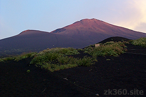
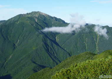
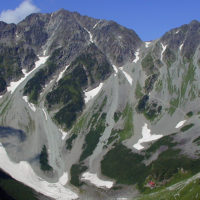
Mt. Fuji (right) and Mt. Hoei (left) looking up from the Gotemba route.
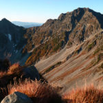
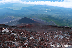
Mt. Houei seen from around the 6th station of Mt. Fuji.
Mt. Houei looking down from the 8th station of Mt. Fuji. The crater looks black.
As you can see, Mt. Houei is certainly a mountain. Now, take a look at Mt. Houei’s spherical panoramic photo.
*Click the letters THETA at the bottom left of the screen to see on a wider screen all three images.
この写真は、Webサイト『絶景360』の一部です。『絶景360』は、こちら(https://zk360.site)からご覧いただけます。 This photo is a part of the website "zk360.site". The URL of English version is https://e.zk360.site/ – Spherical Image – RICOH THETA
Looking up at Mt. Houei and Mt. Fuji at the edge of the second crater (2018/9/5)
この写真は、Webサイト『絶景360』の一部です。『絶景360』は、こちら(https://zk360.site)からご覧いただけます。 This photo is a part of the website "zk360.site". The URL of English version is https://e.zk360.site/ – Spherical Image – RICOH THETA
Spherical panoramic photo in the first crater (2018/8/19)
この写真は、Webサイト『絶景360』の一部です。『絶景360』は、こちら(https://zk360.site)からご覧いただけます。 This photo is a part of the website "zk360.site". The URL of English version is https://e.zk360.site/ – Spherical Image – RICOH THETA
Spherical panoramic photo at the summit of Mt. Houei (2018/8/19)
As you can see in the second panoramic photo, you can get inside the crater. It’s easy to get here. See Access (1) below.
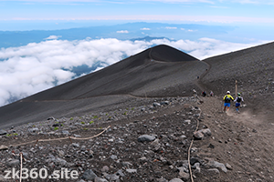
From the bottom of the crater to the summit of Mt. Houei, you have to climb a long uphill. The mountain trail is very difficult to walk because of lava sand. It’s too big to recognize correctly, it looks close, but it will take longer than expected.
However, the scenery is the best when you climb up to the top of the mountain like the third panoramic photo. You can see Mt. Fuji in the background. Suruga Bay, Mt. Ashitaka, the mountains of Hakone, and Lake Yamanaka in the front.
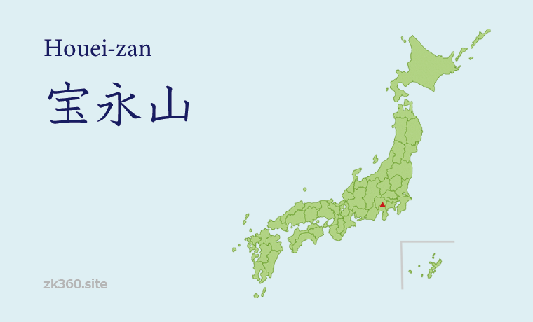
Mountain Area
Southern part of the Chubu region
Access to Mt. Houei
(1) The easiest route is to take a bus to the 5th station of Fujinomiya-guchi and then traverse to the east. About 30 minutes on foot from Fujinomiya-guchi to the edge of the first crater. It takes about 10 minutes from there to the bottom of the crater. It takes about 1 hour from the bottom of the crater to the summit of Mt. Houei. During the mountain climbing season, you cannot drive up to the 5th station. Park your car in the Mizugatsuka parking lot and take the shuttle bus.
(2) From the Mizugatsuka parking lot, you can walk up the Suyamaguchi mountain trail and pass by the 3rd and 2nd craters to reach the edge of the 1st crater. The course time is about 3 hours and 40 minutes. Furthermore, it takes about 1 hour and 10 minutes to reach the summit of Mt. Houei.
(3) It is also a good choice to climb Mt. Fuji first and stop at Mt. Houei when descending. If you go down the Gotemba-guchi route, the mountain trail will be divided into an ascending course and a descending course. A short walk down the descending course, the trail branches into a route to Gotemba-guchi and a route to Mt. Houei. After stopping at Mt. Houei, you can return to the descending course on the Gotemba-guchi route by turning back for about 15 minutes. You can reach Fujinomiya-guchi by going down the crater from Mt. Houei.
(4) When going from Gotemba-guchi to Mt. Houei, go to the left at the branch just ahead of the new 6th station. You will reach the summit of Mt. Houei via a ridge called “Uma-no-se”. The course time is 5 hours or more. You can return to the Gotemba-guchi route, or you can go down to the crater and go to Fujinomiya-guchi.You can climb Mt. Fuji by going from the summit of Mt. Houei to the Gotemba-guchi route. It takes about 4 hours and 20 minutes to reach the edge of the crater in the course time. In addition, it takes about 30 minutes to reach the highest peak, Kengamine.
*You can climb Mt. Fuji by going from the summit of Mt. Houei to the Gotemba-guchi route. It takes about 4 hours and 20 minutes to reach the edge of the crater in the course time. In addition, it takes about 30 minutes to reach the highest peak, Kengamine.
*Appropriate physical strength and preparation are required to climb Mt. Fuji. And we can climb Mt. Fuji only 10 weeks in the summer. For more information, see the article of Mt. Fuji.
To A-Z Index
To Area Index